Rural fencing in Leeton: rice, grain and channel country
Rural fencing in Leeton means fences on flat irrigated land cut by channels, tracks and gates. The Leeton shire covers about 1,100 sq km, and a council economic profile lists rice, citrus, grapes, wheat and vegetables, with some sheep and cattle (the council's economic profile). Describe your job and your enquiry is passed to a local fencing contractor servicing Leeton and surrounds. We refer enquiries; the contractor quotes and does the work.
Griffith shares the same irrigation area but leans towards vines, orchards and small holdings, so the Griffith page is the better read if that is your land. This page leans towards cropping, rice and channels, and also covers Yanco, Whitton, Narrandera and Coleambally.
What the 2021 Census shows for Leeton
Leeton has two ABS QuickStats rows from the 2021 Census, the local government area and the suburb and locality. They are drawn on different boundaries, so do not add them together or compare them line by line.
| Area | People | Median age | Homes | Median weekly household income | Largest industry lines |
|---|---|---|---|---|---|
| Leeton local government area | 11,452 | 38 | 3,961 dwellings | $1,417 | Secondary education 256 people; meat processing 240; grain mill product manufacturing 223; supermarkets 155; primary education 152 |
| Leeton suburb and locality | 9,170 | 38 | 3,873 private dwellings (3,279 occupied) | $1,425 | Secondary education 5.2 per cent; meat processing 5.2; grain mill products 4.3 |
In the suburb and locality, 84.9 per cent of dwellings are separate houses. Farming is not among the five industry lines the ABS lists first. Education, meat processing and grain milling lead, so a farm fence job near Leeton comes from the land around the town and not from the town's own payroll.
Rice, channels and what they mean for a fence line
A rice industry body says most of Australia's rice is grown in the Murrumbidgee and Murray valleys (the rice regions page). The same page says Coleambally was designed for irrigated agriculture in the 1950s. That is the setting: flat paddocks, channels, farm tracks and gates.
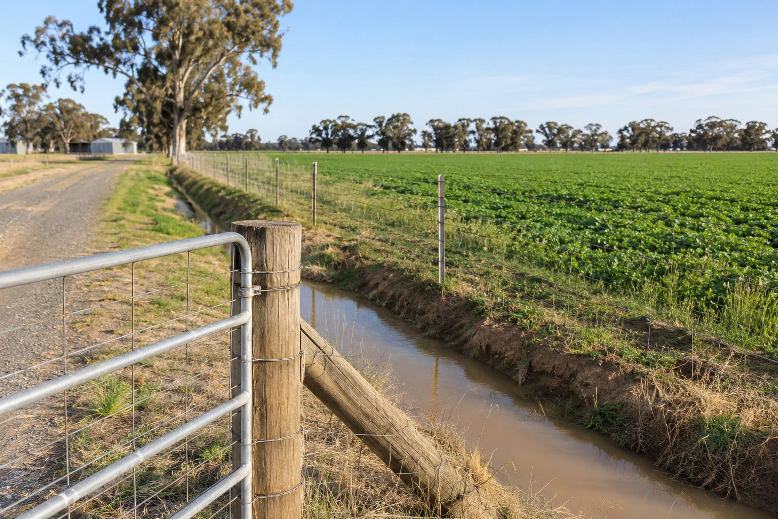
We found no source on fence rules for rice paddocks or channel banks, and nothing on access windows for machinery, so do not expect this page to answer them. Ask the contractor how they will reach the line, which gates they will fit where channels and tracks cross, and what happens if the ground is wet when they arrive. If a channel runs along your boundary, ask the council that covers the land who looks after the bank before you ask who pays for the fence. Our guide to farm boundary fencing covers the neighbour side.
Yanco, Whitton, Gogeldrie and Murrami
Yanco, Whitton, Gogeldrie and Murrami are localities in the Leeton area, and an enquiry from any of them is covered as Leeton and surrounds. Near Leeton there are also two wetlands of international importance, Fivebough and Tuckerbil, listed on the Local Land Services regional profile. That is geography only. The profile says nothing about fences, so if your boundary runs near a wetland, ask the council and Local Land Services what applies.
Coleambally and Narrandera: no pages of their own
Coleambally is in the Murrumbidgee Council area. A secondary source, Wikipedia's Coleambally page, gives 1,152 people at the 2021 Census, an irrigation scheme from the 1950s with land allocated by ballot, a town opened in June 1968, and a distance of about 65 km from Griffith. For the wider Murrumbidgee local government area, the ABS page shows 3,353 people, with other grain growing at 158 people (9.6 per cent) and grain-sheep or grain-beef cattle farming at 135 (8.2 per cent).
Narrandera has no page of its own. In its local government area the ABS reports 5,698 people with a median age of 44, other grain growing at 102 people (4.4 per cent) and grain-sheep or grain-beef cattle farming at 100 (4.3 per cent), on its QuickStats page. For the Narrandera suburb and locality alone the same survey counts 4,369 people. Narrandera and Coleambally enquiries are handled through this page. For stock fences on that mixed country, see sheep and cattle fencing.
Floods, roads and the rest of the questions
Low, flat country can hold water after heavy rain. If a flood or storm has damaged your fence, the flood and fire damaged fence repair page covers what to photograph and ask. If your boundary is a public road, a stock route or a reserve, the roads, stock routes and Crown land page covers what the agencies say. We have no Bureau of Meteorology page for Leeton. The nearest station we fetched is Griffith Airport, which averages 403.2 mm of rain a year (station averages), so treat that as a regional pointer only.
What to send with a Leeton enquiry
Send the locality, the rough length, whether the line follows a channel, track or road, the crop or stock involved, who the neighbour is and photos. Then read the guide to choosing a contractor and ask which licence or registration the contractor holds for your job. Leeton is about 129 km from Wagga Wagga, according to a secondary source. Contractors also service these areas from Wagga Wagga; enquiries from the Wagga Wagga area are better served by our Wagga Wagga site. Send your details when you are ready.
What this page cannot tell you
It cannot tell you what a rice or cropping fence should look like, because we found no source with specifications for channel country. It cannot say who looks after a channel bank, whether a wetland affects your boundary, or what a contractor will do on your soil. Population figures for Coleambally come from a secondary source, and we found no hectares or stock numbers for the shire.
Ask the council, Local Land Services and the contractor, and ask NSW Fair Trading or Building Commission NSW if you are unsure about licensing.
Check the current rules before you rely on this
This page describes the land, census figures and irrigation setting around Leeton, with Coleambally and Narrandera, and what to ask about channel country fences. It describes the rules in general terms as they stood in November 2026. Standards, forms, thresholds and fines change.
The authoritative sources are ABS 2021 Census QuickStats: Leeton (local government area), ABS 2021 Census QuickStats: Leeton (suburb and locality), Economy.id, Leeton about the area (council economic profile), Rice industry body, the rice regions (Murrumbidgee and Murray valleys) and Local Land Services, Riverina region regional profile. Where anything here differs from those sources, they are right and we are not.
We are not fencing contractors, builders, regulators or lawyers. For what applies to your fence, ask the contractor which licence or registration they hold for your job, then ask NSW Fair Trading or Building Commission NSW if you are unsure, and ask the council that covers the land.
Accurate at the time of writing, November 2026. Always check the source before relying on it.