Rural fencing in Deniliquin: sheep, channels and floodplain
Rural fencing in Deniliquin covers a wide spread of land: irrigated paddocks served by earthen channels, sheep country, and floodplain along the rivers. A Wikipedia page lists the Edward River among the main waterways of the Riverina (secondary source). Describe your job and your enquiry is passed to a local fencing contractor. The contractor quotes and does the work; this site only refers.
This page also covers Hay, Conargo, Finley and Berrigan, which have no pages of their own. For stock fences, see sheep and cattle fencing, and for flood-prone frontages the electric fencing page explains why some owners ask about it.
What the 2021 Census shows for Deniliquin
ABS QuickStats for the 2021 Census reports Deniliquin twice: as the Edward River local government area and as the Deniliquin suburb and locality. Each row stands alone because the two boundaries are not the same.
| Area | People | Median age | Homes | Median weekly household income | Largest industry lines |
|---|---|---|---|---|---|
| Edward River local government area | 8,456 | 46 | 3,331 dwellings | $1,240 | Other social assistance 169 people; hospitals 139; grain-sheep or grain-beef cattle farming 125 (3.3 per cent); primary education 120; supermarkets 119 |
| Deniliquin suburb and locality | 7,432 | 47 | 3,727 private dwellings | $1,221 | Other social assistance 4.8 per cent; hospitals 3.9; supermarkets 3.6 |
In the suburb and locality, 89.0 per cent of dwellings are separate houses. Farming is not among the three industry lines the ABS lists for the town. For the Edward River local government area, grain-sheep or grain-beef cattle farming is the third line listed, at 3.3 per cent. So the town's job mix is mostly social assistance, health and shops, and the fence work comes from the surrounding land.
The Murray irrigation district and the Mulwala Canal
An irrigation company's history page and a secondary Wikipedia page (company history, Wikipedia) describe an irrigator-owned district since 1995 with 2,124 landholdings, about 724,000 ha and 2,755 km of earthen channels. The Mulwala Canal runs 156 km through Berrigan, Finley and Deniliquin. Neither source names crops.
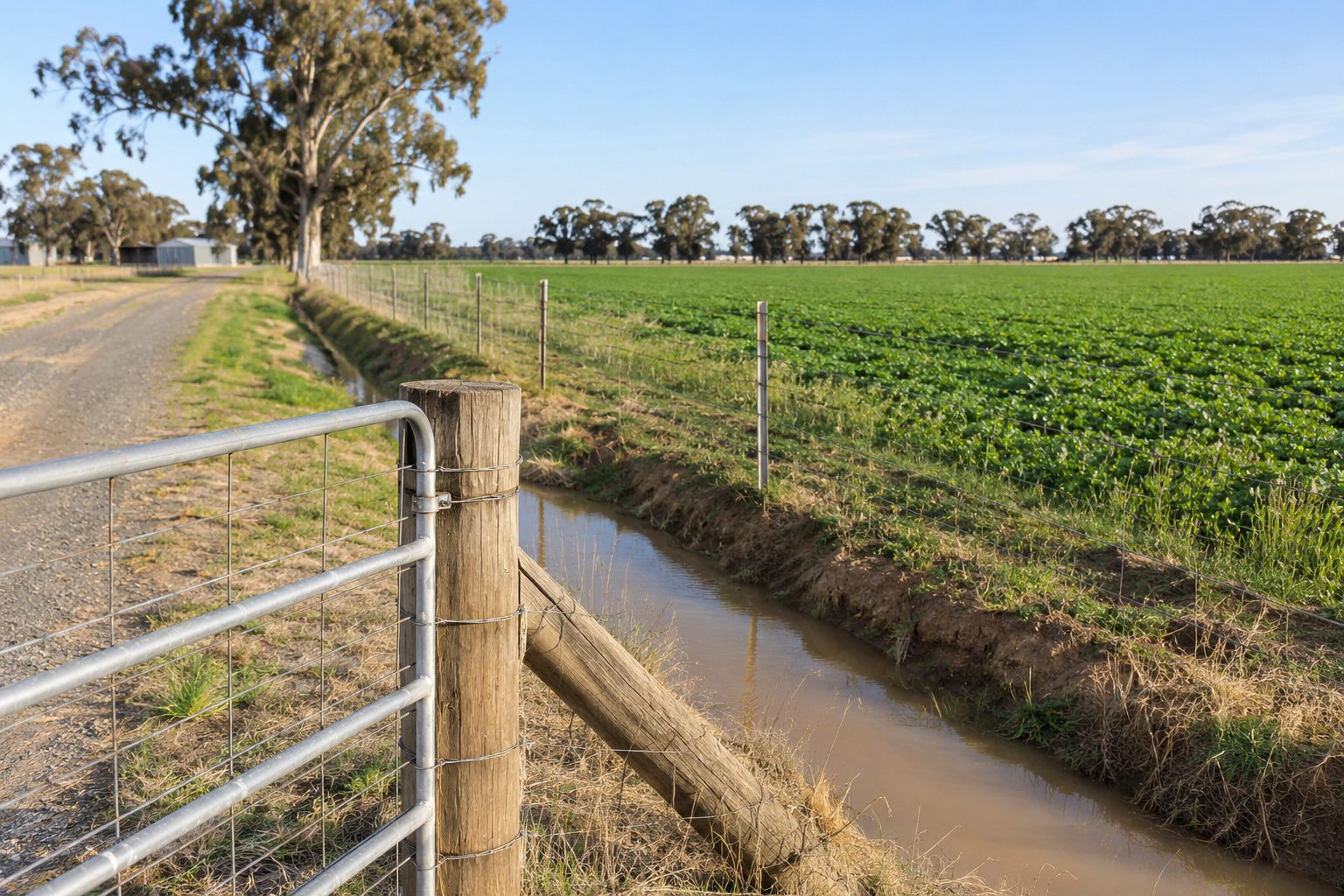
A long channel network means many fences meet a channel, a track or a reserve. We found no source on who maintains fences beside these channels. Ask the council that covers the land and the contractor, and read fences beside roads, stock routes and Crown land if a public road or reserve is also on your boundary.
Flood fence repair and roadside grazing around Deniliquin
If floodwater or debris has damaged your fence, photograph it before any clean-up and keep the photos, as Legal Aid NSW suggests for fence disputes. The flood and fire damaged fence repair page covers the repair side, and the assistance page explains why help depends on declared events and eligibility. We found no open, verified fence-specific assistance for the Riverina.
For design ideas, Victorian Government guidance for riparian fences in flood-prone areas, an interstate source, says no fence can be designed to withstand a major flood. It suggests fences set no more than 45 degrees to the flow, plain wire over mesh or barbed wire because plain wire is easier to clear and re-strain, and fences kept as low as adequate for livestock, generally 1.2 m to 1.4 m. It also says electric fences are often a good choice in flood-prone areas. That is one interstate source, not a NSW rule, so ask the contractor what suits your creek or river frontage.
Edward River Council has a roadside grazing policy. In the version we found, version 2 dated 2018, a Local Land Services permit is involved, the council gives its concurrence, permits run for up to seven days, and grazing is supervised and limited to sunrise to sunset. It states no fencing requirement (council policy). Check the current policy with the council before you rely on it.
Hay, Conargo, Finley and Berrigan
Conargo, Blighty, Booroorban, Mayrung, Pretty Pine and Wanganella are localities in the Edward River area, listed by the regional joint organisation. The Hay local government area is small and sheep-led: the ABS reports 2,882 people with a median age of 48, and specialised sheep farming as the first line at 96 people (7.5 per cent), on its QuickStats page. Berrigan, which includes Finley and Tocumwal, has 8,665 people with a median age of 52, and its listed lines are aged care 166, supermarkets 118 and cheese and other dairy product manufacturing 114 (3.3 per cent), on its ABS page.
Rain and heat at Deniliquin
The Bureau of Meteorology's Deniliquin Airport station averages 372.0 mm of rain a year over 51.0 days with 1 mm or more. The mean annual maximum is 23.7°C, the January mean maximum 33.4°C and the July mean minimum 3.4°C (station averages). That is among the drier figures we found across the region. We found no source linking rainfall to post or strainer behaviour, so ask the contractor how they will set the line on your ground.
What to send with a Deniliquin enquiry
Send the locality, the rough length, the stock or crop, what is on the other side of the boundary, any flood damage, and photos. Read the guide to choosing a contractor and checking a quote, ask which licence or registration the contractor holds for your job, and then send your details.
What this page cannot tell you
It cannot tell you which fence suits your creek frontage, whether a flood will damage it, or who maintains a fence beside a channel. The flood design ideas come from an interstate source and are not NSW rules. We make no claim about how many contractors work in the district or how quickly one can attend, and no claim about which crops or stock are most common near the town.
Take these questions to the council that covers the land and to the contractor, and put any licensing question to NSW Fair Trading or Building Commission NSW.
Check the current rules before you rely on this
This page describes the land, census figures, irrigation network and flood and roadside questions around Deniliquin and the Edward River country. It describes the rules in general terms as they stood in November 2026. Standards, forms, thresholds and fines change.
The authoritative sources are ABS 2021 Census QuickStats: Edward River (local government area), ABS 2021 Census QuickStats: Deniliquin (suburb and locality), Bureau of Meteorology, Deniliquin Airport AWS climate statistics (station 074258), Murray irrigation company, our history (irrigator-owned district; channel network) and Edward River Council, roadside grazing policy (version 2 dated 8 October 2018; check current). Where anything here differs from those sources, they are right and we are not.
We are not fencing contractors, builders, regulators or lawyers. For what applies to your fence, ask the contractor which licence or registration they hold for your job, then ask NSW Fair Trading or Building Commission NSW if you are unsure, and ask the council that covers the land.
Accurate at the time of writing, November 2026. Always check the source before relying on it.